The MapTime website (www.maptime.co.uk) currently has only a single TimeLine. (This will be explained in a future post.) You do not, therefore, need to worry about which TimeLine or TimePoints to use when you first visit the site - the only thing to worry about is where you want the course of Organic Evolution to be plotted. Click on the "TimePoint" tab if you want an explanation of the current time points in the system, or just click "TimeLine" to get started. [Note. Since the addition of multiple TimeLines, you now need to choose a TimeLine and click "View TimeLine" to get started - or click on the Organic Evolution tab.]
This will open up the main TimeLine page, which lists, for your information, the time points that will be plotted. Most of these come from The New Scientist evolution of life page, for reasons we will explain another time. For now, just scroll down to the map so that you can get started.
To make a MapTimeline, you only really need two things: (1) an end point, usually where you currently are (or intend to give your Deep Time lecture), and (2) a start point, which should be somewhere your audience will know. At this stage, it matters not if you do not have a (2) - you can always experiment later. To give an example that will hopefully resonate with most people, I will create a MapTimeline that goes from John o'Groats in Scotland to Land's End in Cornwall - the furthest two points apart on the British mainland.
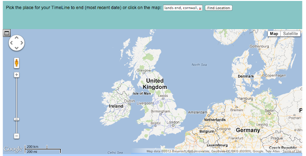
The first step is to choose the end point of your MapTimeline. This will correspond to the present day. You can do this either by searching for a location (enter the name in the box and click "Find Location") or just by clicking on the map. Feel free to pan or zoom but resist the urge to maximise the map at this point. In the current implementation, this will hide all the buttons and you'll get stuck! (Something that is on the list of things to change.)
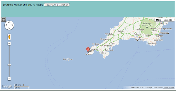
Once you have selected an initial point on the map, pan and zoom using the usual Google Map controls (click and drag to pan, double-click to zoom in, double-right-click to zoom out) to get a closer look and drag the marker around until it is just where you want it. If giving a lecture, try to get it on the building. (Note that we have not yet tested it extensively with buildings that are a long way from roads - please report any anomalies with the ultimate MapTimeline.) Once you are happy, click "Happy with Destination", which will bring up a red circle:
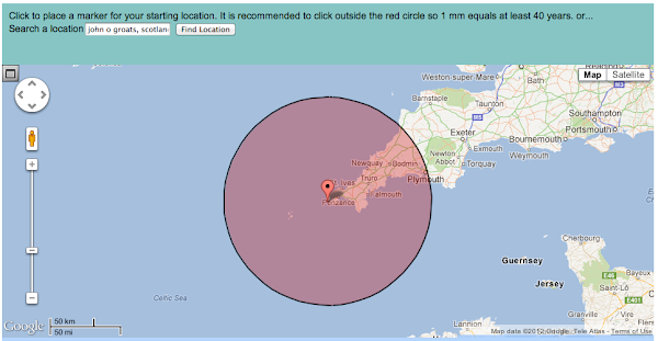
This circle represents the minimum suggested distance for use with Deep Time, such that 40 years is 1mm and thus a human life is still visible. For different TimeLines in future, this distance will be different. As with the Destination, you can either search for your desired location (I searched for "John O Groats, Scotland") or manually place the Start point.
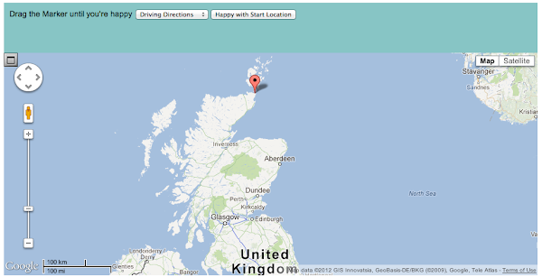
Note: you may have to pan the map to find your Start point pin, even if you search for a location. Currently, the map stays on the Destination, so zoom and pan until you find your Start point. As with the destination, you have the option of moving the pin around until you are happy. Then click "Happy with Start Location". At this stage, you also need to choose whether you want Driving Directions or Walking Directions.
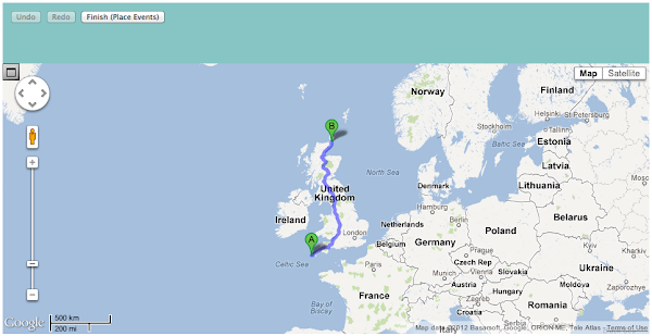
The route for your MapTimeline will now appear. You can edit the route using the usual Google Map controls until you are happy with it. (Unfortunately, there is no "Back" function at present; if you decide that you are really unhappy, just start again. The process gets quicker with practice anyway!) Once satisfied, click "Place Events" and the real fun starts.
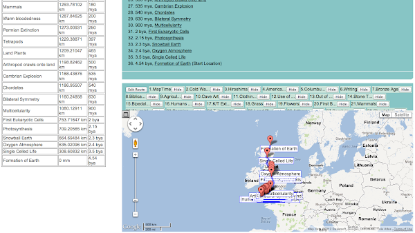
All the TimePoints on the TimeLine will now be placed along your route at a distance proportional to time. The table on the left of the page shows the actual distances - if you want to remake the MapTimeline elsewhere, or place physical markers in your lecture theatre, this table is invaluable. (In this screenshot, the distances are from the Start but they have now been switched to be the distance from the Destination, i.e. your current location, as discussed below.) It can look a bit of a mess but you can get around this by zooming in and hiding unwanted events.
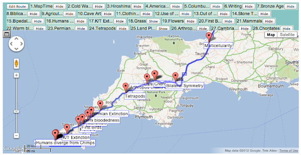
In this MapTimeline, for example, most of the action happens following the origin of multicellularity, a few miles south of Bristol. I hid "land plants" and "grass" because they were obscuring "Tetrapods" and the "K/T extinction" - if your focus was on plants, you would obviously hide something different. Once you are finally happy with your route and TimePoints, then you can maximise to get a full view of your MapTimeline:
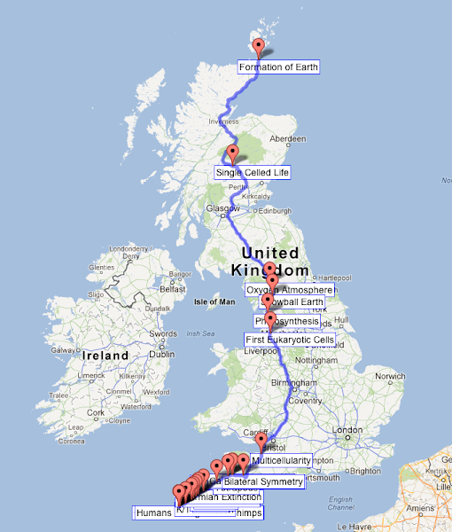
However much you zoom, there are still going to be modern events that overlap each other - to some extent, that is the point! Travelling the 1347km from the top of Britain to the bottom, for example, America gained independence around 7cm away from the end of the route! (It is Independence Day, today!) Clearly, you are not going to see this on a Google Map scale view, even at maximum zoom. That's where the table of distances really comes in. Here is the example for the John o'Groats to Land's End route:
| Event | Distance | Years |
|---|---|---|
| MapTime | 0 mm | 2012 AD |
| Cold War Ends | 6.82484 mm | 1989 AD |
| Hiroshima | 1.98811 cm | 1945 AD |
| American Independence | 7.00288 cm | 1776 AD |
| Columbus "discovers" America | 15.43008 cm | 1492 AD |
| Writing | 1.48337 m | 5 kya |
| Bronze Age | 1.63173 m | 5.5 kya |
| Agriculture & villages | 2.96703 m | 10 kya |
| Cave Art | 10.38534 m | 35 kya |
| Clothing/Jewellery | 21.36443 m | 72 kya |
| Use of Fire | 474.77151 m | 1.6 mya |
| Out of Africa | 534.11799 m | 1.8 mya |
| Stone Tools | 741.83065 m | 2.5 mya |
| Bipedal walking | 1.72105 km | 5.8 mya |
| Humans diverge from Chimps | 1.78039 km | 6 mya |
| K/T Extinction | 19.2876 km | 65 mya |
| Grass | 20.77127 km | 70 mya |
| Flowers | 38.57521 km | 130 mya |
| First Birds | 44.50986 km | 150 mya |
| Mammals | 53.41183 km | 180 mya |
| Warm bloodedness | 59.34648 km | 200 mya |
| Permian Extinction | 74.18309 km | 250 mya |
| Tetrapods | 117.80275 km | 397 mya |
| Land Plants | 137.98056 km | 465 mya |
| Arthropod crawls onto land | 148.36619 km | 500 mya |
| Cambrian Explosion | 158.75182 km | 535 mya |
| Chordates | 160.23548 km | 540 mya |
| Bilateral Symmetry | 186.9414 km | 630 mya |
| Multicellularity | 267.05914 km | 900 mya |
| First Eukaryotic Cells | 593.46476 km | 2 bya |
| Photosynthesis | 637.97461 km | 2.15 bya |
| Snowball Earth | 682.48447 km | 2.3 bya |
| Oxygen Atmosphere | 712.15771 km | 2.4 bya |
| Single Celled Life | 1038.56333 km | 3.5 bya |
| Formation of Earth | 1347.165 km | 4.54 bya |
Hopefully this gives enough information to start playing with the site. New features are being add quite regularly, so please do both experiment and give us feedback on the good or the bad. We will make an FAQ once we have some!

Just tried it out on a route in the Netherlands that I am very familiar with from childhood (Lunteren > The Hague) and it works a treat!
ReplyDelete